The Canoe Is the People
Indigenous Navigation in the Pacific


Satawal Ways
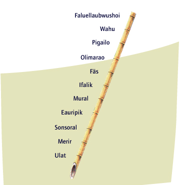
Yet (Pole Charts)
The navigator uses the image of a yaoiteyet, or long bamboo pole, to help remember what he will find when travelling from one island in a straight line to another under a particular star. The pole charts that he keeps in his mind list reefs GLOSSARY reefs - areas of rock or coral below the surface of the water , islands, and other reference points.